Stops for autocars in Leuven
Pick-up & drop-off points inside the ring road
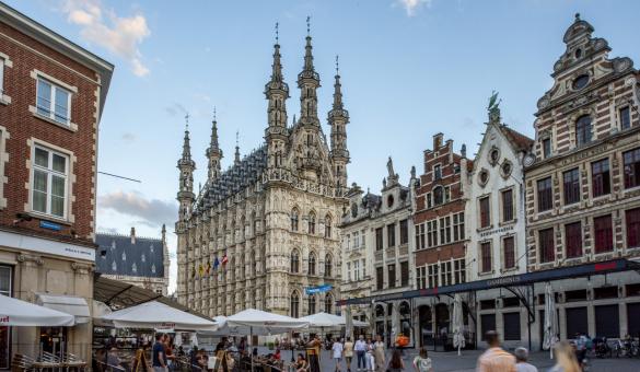
Locations nearby & walking distance: - Town Hall & St. Peter's Church (230m • 3')
- University Hall (350m • 5')
- Museum M Leuven (350m • 5')
- University Library (600m • 8')
| Stop Ferdinand Smoldersplein - Across Ferdinand Smoldersplein 1, 3000 Leuven
- Coördinates: 50.880277, 4.701156 • Google Maps
- 1 parking space
- Max. parking time: 30 minutes
- Access permit required
- Parking disc is mandatory
|
Locations nearby & walking distance: - St. Gertrude's Abbey & Church (400m • 5')
| Stop Dirk Boutslaan - Near Dirk Boutslaan 62, 3000 Leuven
- Coördinates: 50.881256, 4.697493 • Google Maps
- 2 parking spaces
- Max. parking time: 30 minutes
- Access permit required
- Parking disc is mandatory
|
Locations nearby & walking distance: - Botanical garden (240m • 3')
- Irish College (800m • 11')
| Stop Sint-Jacobsplein - Near Sint-Jacobsplein 26, 3000 Leuven
- Coördinates: 50.880074, 4.690954 • Google Maps
- 2 parking spaces
- Max. parking time: 30 minutes
- Access permit not required
- Parking disc is mandatory
|
Locations nearby & walking distance: | Stop Karel Van Lotharingenstraat - Near CLB, Karel Van Lotharingenstraat 6, 3000 Leuven
- Coördinates: 50.8820505,4.7000344 • Google Maps
- 1 parking space
- No time limit
- Access permit not required
- Parking disc is mandatory
|
Locations nearby & walking distance: - Train & bus station Leuven (200m • 3')
| Stop De Lijn Leuven Station Perron 14 & 15- Near Diestsepoort 6, 3000 Leuven
Coördinates: 50.88298,4.7136797 • Google Maps: platform 14 • platform 15 - 2 parking places
- Stop for max. 5 minutes!
- Busses of De Lijn always have priority
- Access permit not required
|
Pick-up & drop-off points outside the ring road |
Locations nearby & walking distance: - Brewery Stella Artois (650m • 9')
| Stop Vuurkruisenlaan- Near Hotel Novotel, Vuurkruisenlaan 4, 3000 Leuven
- Coördinates: 50.885758, 4.711099 • op kaart
- 1 parking place
- Max. parking time: 30 minutes
- Access permit not required
- Parking disc is mandatory
|
Location: - Leuven/Heverlee
(Parkpoort/Ruelensvest)
| Stop Paul van Ostaijenlaan- Near Don Bosco, Paul Van Ostaijenlaan 6, 3001 Leuven
Coördinates: 50.8671988,4.7057466 • Google Maps - 1 parking place
- Max. parking time: 30 minutes
- Access permit not required
- Parking disc is mandatory
|
Car parks for coaches in Leuven
Car parks outside the ring road
You do not need an access permit for these parking spots.
Locations nearby & walking distance: - Vaartkom (150m • 2')
- Brewery Stella Artois (550m • 8')
- OPEK (300m • 4')
- De Hoorn (300m • 4')
- Sluispark (400m • 5')
- Abbey Keizersberg (600m • 9')
| Parking Engels Plein AttentionThe parking places for autocars on Engels Plein are not accessible from 1 November 2025 until 31 January 2026 - Near Engels Plein 3, 3000 Leuven
- Coördinates: 50.888291, 4.705376 • Google Maps
- Accessible 24/7
- 6 parkings places
- No time limit
- Access permit not required
- Free of charge
- Parking disc not mandatory
|
Locations nearby & walking distance: - Philipssite (0m • 0')
- Park Abbey (1km • 13')
| Parking Philipssite - Nieuwe Kerkhofdreef, 3001 Leuven (Heverlee)
- Coördinates: 50.869744, 4.712851 • Google Maps
- Limited accessibility:
- Monday-Saturday from 9:00 to 18:00:
- 1 parking space: max 3 hours
- 2 parking spaces: max 4 hours
- Monday-Saturday from 18:00 to 9:00: no time limit
- Sunday: no time limit
- 3 parking places
- Access permit not required
- Parking disc is mandatory
|
Locations nearby & walking distance: - Botanic garden (800m • 11')
- Great Beguinage (900m • 13')
| Parking Bodart- Veilingweg, 3001 Leuven
- Coördinaten: 50.87264, 4.68909
- 22 parking places
- Accessible 24/7
- Access permit not required
- Parking disc is notmandatory
|


